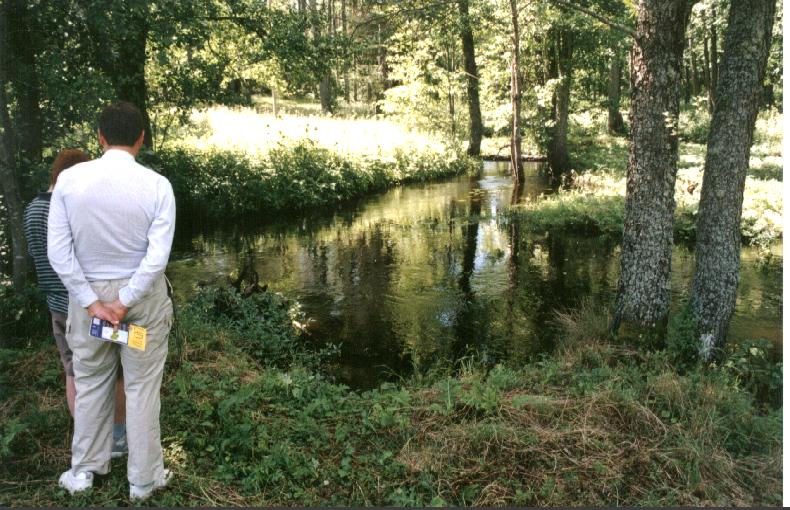
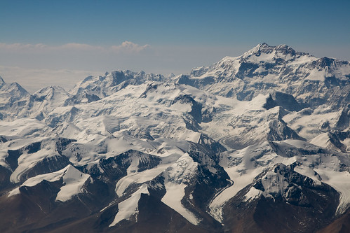
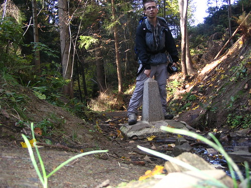
all fully agreed & marked de jure tripoints except as otherwise noted
country digraphs used for designating the trijunctions & boundaries are per the decoding table
& are arranged alphabetically
with directional suffixes e&w or n&s added as needed to distinguish 10 pairs of twin trijunctions
code elements are usually familiar or easily inferable
both separately & in composite
& they are also clarified by the accompanying details
on the other hand
to correctly encipher plain english country names for specific tripoint searches etc
001 adesfre 1868 esfr marker 427 at portella blanca
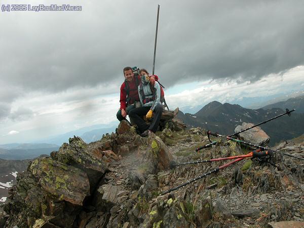
002 adesfrw summit point of pic de medacorba marked by cairn
004 aeomsa tripoint at umm az zamul wells mostly if not entirely agreed but not yet formally marked
005 afcnpk disputed by afghanistan & probably unmarked at unnamed peak in pamirs elev 5630m per ibs at roughly 37n02 74e34 per topo
006 afcntj probably at unmarked ridge junction elev 5523m near summit of mt povalo shveykovskiy tho ibs seems to indicate summit & elev 5670m
007 afirpk 1896 afgb marker 186 at kuh e malek siah summit but repudiated by afghanistan
008 afirtm on thalweg in dry former bed of avulsed hari rud river at zulfikar pass in alignment with remote pair of 1948 afsu reference markers numbered 1
009 aftjuz on thalweg of amu darya possibly in alignment with remote pair of 1948 afsu reference markers numbered 107 over 1
010 aftmuz formerly on thalweg of amu darya & likely still within river channel after avulsion between remote 1948 afsu reference marker pair number 91 over 2
011 algrmk tripoint in lake prespa about 1300m ssw of golem island marked by westernmost of 12 new grmk buoys may also align with old algr & alyu buoys
012 almers 1925 alyu marker numbered b28 over 4 at tromedja summit elev 2366m now in detached kosovo
013 almkrs remonumented in 2008 as agreed with kosovo as distinct from serbia at mt serupa summit elev about 2100m
014 amazge soviet position likely still unmarked on ridge line near saddle southwest of mount babakyar in roughly 41n18 45e1
015 amazire on thalweg of aras river in karabagh occupied territory remotely monumented by a pair of 1957 irsu markers numbered 35
016 amazirw on thalweg of aras river at a ridge crossing that appears not to have been marked by the 1957 irsu demarcation
017 amaztr on thalweg of aras river marked remotely by a pair of 1926 sutr markers numbered 4
018 amgetr 1926 sutr marker 148 at unnamed summit
019 aocdcg where indefinite cdcg descending chiloango river meets aocd ascending thalweg at low ridge carrying aocg & marked remotely by 1904 frpt pillar j
020 aocdzm on watershed divide probably marked by 1915 gbpt pillar 1 & or 1915 bept pillar 1 but possibly also 1934 begb pillar 46
021 aonazm marked by 1964 ptgb beacon 37 if not also 1931 gbza provisional beacon 9 along tree line on eastern edge of kwando flood plain entering caprivi
beacon consists of iron auger driven 140cm into ground covered by concrete slab & concrete block pillar 46cm in both height & diameter & may incorporate other markers & or additional numbers 1 & 32
022 arbocl probably unmarked if indeed ever visited at what is thought to be the more southerly of the twin summits of cerro zapaleri
023 arbopy on thalweg of rio pilcomayo more likely in alignment with 1939 bopy pillars i&ii than as demarcated on 1940 arbo survey map if there is a difference
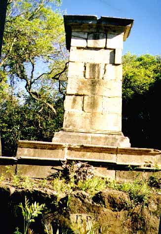
024 arbrpy mismatched trijunction of arbr on thalweg of iguacu with brpy undefined in parana & arpy on parana median line witnessed by 3 matching obeliskoids
025 arbruy tripoint position on thalweg of rio uruguay opposite foot of isla brasileira is per 1927 arbr & 1961 aruy accords tho title to island is disputed by uruguay
027 atchit tripoint established at piz lad summit in 1919 has masonry marker in bedrock apparently dated 1920 tho 1924 atit & 1927 chit demarcations are known
028 atchlin atch & chli agreements indicate the mittelgerinnes or midline of the main sluiceway at the intersecting sight line of 1955 atli markers 135 & 136
029 atchlis summit of naafkopf marked whether formally or informally by cross but reportedly in process of formal monumentation or remonumentation
030 atczde at plockenstein summit remonumented 1993
031 atczsk probably at median junction in confluence of thaya & morava rivers based on precedent of 1928 austria czechoslovakia agreement
032 athusi elegant monument commemorating dates of treaty of trianon & the creation of all 3 states party appears to date from early 1920s
034 atitsi position adjusted very slightly in 1924 at or near summit of ofen aka forno aka pec by a single marker numbered respectively xxvii over 294 & p519 & 1
035 azgeru tho probably still unmarked the soviet tripoint does not appear to be in doubt even as the exact alignment of the azru convergent remains uncertain
037 azirtr at thalweg junction of aras & kara su in alignment with a remote pair of 1957 irsu markers numbered 1
040 bahrme yugoslav position possibly still unmarked about 2km north of dubravka & about 500m east of a road & likely at a high point on a ridge line
041 bahrrs yugoslav position probably on thalweg of sava at or very near confluence of lukavac but none of the available topos shows the critical hrrs boundary
042 bamers yugoslav position likely still unmarked if not undefined is depicted variously on maps about 5km east of metaljka at roughly 43n32 19e13
043 bdinmm possibly marked by 1894 or 1902 gb pillar number 1 & a recent bdmm pillar at a ridge junction half a mile south of reng tlang triangulation station
044 bedelu demarcated riverine condominial triline on west or right half of the river ours perpendicular to the center of the mouth of ribbach creek
045 bedenl octagonal obeliskoid monument & pavement demarcations of erstwhile quadrijunction may date respectively from 1830 & 1920
046 befrlu at median junction of the river chiers & bruehl creek in alignment with a remote pair of befr markers numbered 1
047 bfbjne on median line of river mekrou at n11d54m15s e2d25m10s clarke1880ellipsoid per 2005 icj bjne decision
048 bfbjtg probably marked by a 1912 defr pillar at point 109 in roughly 11n00 0e55

049 bfcigh on thalweg of black volta at roughly n9d29m35s w2d41m21s based on map evidence in the absence of demarcation
050 bfciml at confluence of danboro & zagoundouba forming leraba occidentale but whether at median or thalweg junction is in doubt
051 bfghtg evidently on median line of kulutamsi river at 1930 frgb pillar 148 tho the pillar itself is also described perhaps in error as marking the tripoint directly
053 bggrmk common marker number 1 at tumba summit
054 bggrtr by lausanne treaty on median of main channel of maritsa river near kavak island but possibly moved to pillar 1 upon the island by 1926 commission
055 bgmkrs 2001 mkrs agreement fixed tripoint at 1922 bgyu marker 106 which was replaced by a tripartite marker in 2002
056 bgrors on the thalweg of the danube at the confluence of the timok hypothetically opposite the middle of its mouth since the bgrs delineation is indefinite
058 bicdrw at thalweg junction of the luhwa & rusizi rivers
059 bicdtz upon the indefinite median line of lake tanganyika & the parallel of 1924 begb pillar number 1 at the mouth of ndyakalika ravine in roughly 4n25
060 birwtz at thalweg junction of mwibu & kagera rivers
061 bjneng moved in 2005 by icj bjne judgment from median line of niger river to thalweg at point 154 in n11d42m39s e3d35m18s clarke1880ellipsoid
062 bobrpe at median junction of the rivers yaverija & acre
063 bobrpy probably at thalweg junction of rio negro with rio paraguay since both bopy & bobr follow the thalwegs tho brpy is technically undelineated
064 boclpe tripartite monument at visviri in accordance with 1930 clpe protocol updating 1926 clpe marker 80 aka 1904 bocl marker 5
065 brcope on the thalweg of the amazon at the parallel of latitude of the center of the mouth of the quebrada santo antonio dividing leticia & tabatinga
066 brcove by agreements fixed at the irrational triple intersection point of 2 demarcated geodesic boundary lines & the thalweg of the rio negro
067 brfrsr position on tumucumaque ridge at source of litani feeder likely named coule coule is marked by french tower & agreed by br but disputed by suriname
068 brgysr position on tumucumaque ridge at source of kutari river marked by 1939 brgb pillar 132 is disputed by suriname
069 brgyve marked position at summit of mount roraima is per brve 1931 & gbve 1905 yet disputed by venezuela
070 btcnine indefinite position on thagla ridge on the so called line of actual control southeast of me la & north of west end of mcmahon line is rejected by china
071 btcninw indefinite position as china is pressing bhutan both diplomatically & by military patrols for control of up to 89 sq km of the doklam plateau
072 bwnaza tho map evidence indicates a marker none has been reported by visitors so tripoint in the normally dry bed of nossob river could well be unmarked
073 bwnazm as de facto bwzm frontier is far busier than nazw frontier a bwnazm trijunction is commonly presumed immediately above middle of ferry crossing
074 bwzazw probably at the median junction of the shashi & limpopo rivers but two of the convergents are not precisely delineated
075 bwzmzw situation is similar to that of 073bwnazm except this trijunction is generally presumed to lie directly below the middle of the ferry crossing
boundary clarifications expected for bridge construction make it likely that the bwzmzw & bwnazm trijunctions will be supplanted in the tricountry registry by the presently unlisted bwnazw & nazmzw trijunctions
076 byltlv concrete demarcations in 6 meter neutral square near liudevinova lake appear to date from 1990s
077 byltpl on median line of marycha river beside plsu marker pair numbered 1789
078 bylvru at median junction of neverica & zilupe rivers
079 byplua probably on median line or thalweg of bug river perpendicular to south bank of moscickogo canal near plsu marker pair numbered 1123
080 byruua monumental kurgan druzhby marker is centered however improbably on an unmarked & generally overlooked tripoint
081 bzgthn negotiated but still only hypothetical equidistant maritime point at roughly 15n55 88w13 based on regional facilitators proposals
082 bzgtmx marked in 2002 tho not finally agreed some 200 meters east of previously presumed position at gtmx monument 107 aka vertice aguas turbias
because the new prospective position involved a concession of error & a boundary correction & was fully consented to it seems likely to eventually become formally adopted
083 cdcfcg nominally on thalweg of ubangi at confluence of gouga & hypothetically opposite center of mouth of gouga as cfcg delineation in gouga is unspecific
084 cdcfsd monumental 1924 befrgb rock heap on the ill defined congo nile watershed divide
085 cdrwug at summit point of mount sabinyo but probably unmonumented because numerous peak baggers have not reported seeing any markers in the mist
086 cdsdug on watershed divide but not fixed with certainty & described in uganda constitution as a point about 300 meters south of the source of the river kaia
087 cdtzzm probably on median line of lake tanganyika at an indeterminate position aligned with a certain lost cape akalunga & an uncertain point on lake mweru
088 cfcgcm on lesser thalweg of sangha river at about n2d13m20s but this position is based only on inconsistent map evidence because cfcg is undemarcated
089 cfcmtd on thalweg if discernible or else on median line of mbere river at a position based only on map evidence & nominally at n7d31m40s e15d29m40s
090 cfsdtd probably on median line of westward flowing tributary or headstream of the aoukale river exactly 1 kilometer east of the easternmost point of lake tizi
091 cgcmga on thalweg of river ayina if discernible but otherwise on its median line at the intersection of n2d10m20s
093 chfrit at a possibly unmarked ridge trijunction elev3750m just northwest of the summit of mont dolent elev3820m & generally unnoticed by peak baggers
094 cignlr at northwesternmost source of nuon river on crest of nimba mountains reportedly marked by a concrete post which may be a 1929 frlr pillar
095 cignml uncertain colonial position supposedly at headwaters of dougoulinfolo on baoule sankarani drainage divide & roughly n10d10m15s w7d58m40 per ibs
096 cmgagq presumably demarcated cmgc & gagq corner point joined by indefinite cmga closing segment from kye mvezeu confluence over a mile to the east
097 cmngtd unmarked on now dry bed of lake chad & fixed by 1931 frgb agreement decisively if without regard to datum at 13n05 & yet only vaguely at 14e05
098 cninmm indefinite mcmahon line position disputed by china at ridge trijunction on brahmaputra irrawaddy watershed divide directly above & north of diphu la
099 cninnpe probably unmarked summit point on jongsang peak is highest tripoint in the world at 24485 feet asl & the most agreeable of the 6 cnin trijunctions
100 cninnpw unmarked ridge trijunction directly above & south of lepu lekh pass in roughly 30n12 81e02 maintained by india since 1962 but rejected by nepal
101 cninpk tho karakoram pass is often cited the actual limit of indian control is at or near sir kangri peak just above & west of indira col & siachen glacier
102 cnkgkz probably unmarked ridge trijunction & secondary peak of khan tengri 5 km east of actual summit
103 cnkgtj probably unmarked primary summit point of zarya vostoka elev 6350m
104 cnkpru condominial triline in left half of tumen river bed at 1993 cnru marker pair 423 was negotiated in 1998 & apparently demarcated trilaterally in 1999
105 cnkzru at nameless probably unmarked ridge junction elev 3424m in roughly 49n07 87e17
106 cnlamm on thalweg of mekong river & watershed divide just below confluence of nan la ho
107 cnlavn first tripartite marker 2005 at summit of shiceng dashan aka khouang lashan mountain elev 1853m
108 cnmnrue first tripartite marker 1993 elevated above salt marsh on stilts
109 cnmnruw probably unmarked summit point of tavan bogd uul elev 4082m
110 coecpe apparently agreed at thalweg junction of putumayo & gueppi rivers & witnessed by 1999 ecpe marker 206 in s0d7m10 w75d15m27
111 czdepl at the median junction of the lusatian neisse & oldrichovsky brook & thus perpendicular to the center of the mouth of the obliquely entering tributary
112 czplsk 2007 tripartite obeliskoid in mostly dry creek bed is first official demarcation
113 defrlu demarcated riverine condominial triline traversing the right or eastern half of the main channel of the moselle river & a lock island & side channel
114 djeret changed by 2006 eebc paper demarcation to 1954 etfr pillar 90 at summit of musa ali from 2002 eebc dispositif position a few hundred meters east
115 djerye assuming equitable djet division of dumeira islands a hypothetical equidistant maritime tripoint should fall in bab al mandab at roughly 12n46 43e17
116 djetso evidently at the summit of madaha djalelo hill elev 492m & marked by 1953 etfr primary monument number 1
117 dzlyne in shifting dunes where normal demarcation would be impractical at n23d30m54s e11d59m54s6 elev1010m per ibs but 23n30 12e0 per soviet topo
118 dzlytn evidently at a new position between 1911 frtr pillars 220 & 221 since 1970 dztn agreement & likely also with a tall new marker spotted in satpic
119 dzmamr unmarked on west bank of wadi in 8w40 per ibs at n27d17m40s tho soviet topo shows 27n22 & no wadi
120 dzmlmr unmarked where oblique southern boundary of algeria crosses n25 estimated by ibs at 4w50 but shown by soviet topo at about 4w49
121 dzmlne colonial position not fixed with certainty but estimated by the ibs at n19d8m30s e4d14m30s & shown by soviet mapping at more nearly 19n8 4e15
122 eelvru on median line of pededze river about 70 meters above laikupe confluence witnessed by eelv marker 46 plus1379 with lvru converging at about n40e
123 egiljo hypothetical equidistant maritime tripoint at 1996 egjo terminal point mb3 in n29d27m12s1667 e34d55m16s3595 subject to egyptian concurrence
126 eretsd per eebc either at or opposite the center of the river setit or until demarcation its main channel in dry season at roughly n14d15m4t e36d33m6t downloadable topo suggests how far the defining khor royan confluence has migrated since the lost 1903 etsd riverbank demarcation of it http://en.poehali.org/maps/200k--d37-13.html
127 etkesd not fixed with certainty but near 1970 etke pillar d23 on shore of the former sanderson gulf of nw lake rudolf & 200 meters s of se end of okolon ridge
128 etkeso on thalweg of daua river about 450 meters above village of malca rie & opposite 1927 gbit pillar 1 on right bank
129 finoru subsequently capped by pyramid 1826 ruse cairn 353 at krokfjellet aka muotkavaara has been a tripoint since 1907 & is maintained by 1953 protocol
130 finose artificial tripoint island in lake goldajavri surrounded by boardwalk is fino marker 294 a large concrete pedestal for a top marker dating from 1926
131 gngwsn 1906 frpt pillar 58 in n12d40m30s w13d42m30s
132 gnlrsl on center line of mouth of dundugbia stream & left or south bank of makona or moa river at or within 3 meters of 1911 gblr pillar 1 & 1913 frgb cairn xvi
133 gnmlsn where an unspecified feature of the balin ko river intersects the low crest line of the konkoniouma mountains in roughly 12n25 11w22
134 gthnsv monumented at or very near the summit of cerro monte cristo per 1936 trilateral protocol tho a nearby observation tower rises above it
135 hnnisve smaller of 2 tridominial areas of shared internal waters lies within outer gulf more than 3nm from coasts of all 3 countries per 1992 icj judgment
136 hnnisvw larger icj tridominial area straddles closing line of gulf beyond 3nm from coasts & comprises shared internal waters & shared 12nm territorial seas
137 hrhurs de facto & historic position on danube thalweg aligned with remote 1920 huyu markers 415 & 420 is disputed by croatia because yugoslav cadastral boundary was on canal beside huyu marker 465 downloadable topo showing marker positions http://en.poehali.org/maps/100k--l34-074.html
138 hrhusi possibly disputed position in mura at former thalweg junction with kerka apparently supported by numbered hrhu & husi boundary points or markers
139 hritsi after considerable delay this maritime tripoint negotiated in 2001 may yet be finally agreed or modified
140 hurors so called triplex confinium monument position modified from its 1920 trianon position by 1923 protocol is huro & royu pillar 1 & has a detachable cap
141 huroua probably at median junction of the river tur & a tributary stream identified as the palal on soviet topo & witnessed by 1949 rosu & husu markers 1
142 huskua probably on median line of tisza river witnessed by skua marker pair numbered 375 if not also huua marker pair 375
143 idmysge maritime tripoint remains to be negotiated but should fall at roughly 1n16 104e7 based on extrapolations from existing agreements
144 idmysgw maritime tripoint remains to be negotiated but should fall at roughly 1n11 103e32 based on extrapolations from existing agreements
145 iljosy undof buffered trijunction on yarmouk river a couple hundred meters wide in between alpha & bravo lines at their place of narrowest separation
146 illbsy undof buffered trijunction along mount hermon ridge line extending about 10 miles in between alpha & bravo lines at their place of greatest separation
147 iqirtr 1914 iqir pillar 125 over 12 & or 1926 iqtr pillar 99 at source of hajji bak river on kurdistan ridge line about 2km south of dolampar or dalamper summit
148 iqjosa position revised in 1984 about 12km southeast from previous position on jabal unayzah & possibly demarcated at about n32d9m30s 39e12
149 iqjosy no known marker tho ibs gives position down to the millisecond as n33d22m29s023 e38d47m33s212 without datum or explanation
150 iqkwsa marked by 1993 iqkw pillar 1 & later iqsa pillar 1 on thalweg of wadi al batin in mouth of wadi al awja at n29d06m04s2128 e46d33m10s9431 wgs84
151 iqsytr at thalweg junction of rivers chabur & tigris
152 kesdug fixed only approximately at 4n13 e33d59m30 per ibs & while soviet topo agrees with this longitude it indicates the latitude is much closer to 4n14
153 ketzug in lake victoria at 1s0 & approx 33e56 but keug resurvey & demarcation are reportedly in progress to resolve nearby migingo island dispute
154 kgkzuz soviet position at ridge junction named chatangat triangulation station was recently reaffirmed but is probably still unmarked
155 kgtjuz soviet position possibly still unmarked in roughly 40n13 70e59
156 khlath delimited at a pass on the preah or dangrek ridge from which the headstream of the tonle repou descends & demarcation was projected for 2009
157 khlavn position presumably unaltered from historic location at ridge junction was agreed in 2007 & demarcation was projected for 2009
158 kztmuz soviet position at intersection of apparent geodesic lines on salt pan beneath chink kaplankyr is probably still unmarked at about n41d19m12s 56e0
159 lammth evidently in the narrows beside sop ruak in the so called golden triangle area at the rather gradual thalweg junction of the nam kok & mekong rivers
160 ltplru concrete marker witnessed when last reported only by a pair of plsu flagposts numbered 1987 tho lithuania has recently initiated discussions
161 lynetd probably unmarkable in shifting dunes at n23 e15 but all 3 convergent boundaries are well depicted on maps & reasonably clear in practice
162 lysdtd fixed by colonial convention at 19n30 24e0 & marked by a 1923 frgb cairn
163 mdrouan soviet position on thalweg of prut at roughly 45n28 28e13 aligned with & witnessed remotely by 2004 mdua marker pairs 0002 & 0001
164 mdrouas at former thalweg junction of prut & danube possibly in alignment with remote 1949 rosu markers 1335 over 36 & likely with two 2004 mdua pairs
165 mlmrsn despite faulty texts the tripoint is probably on the north or right bank of the senegal river opposite the midpoint of the mouth of the river faleme
166 mwmztz in the middle of the mouth of the txuinde aka chiuindi aka kwindi river on the east shore of lake nyasa in about n11d34m30
167 mwmzzm marked by 1904 gbpt beacon 38 nominally where latitude 14s0 crosses the nyasa zambezi watershed divide most likely at about e33d14m32s
168 mwtzzm marked at summit of nankungulu hill by 1898 degb pillar 2 tho it may have been replaced by a pillar 582 or 588 of unknown origin possibly in 1935
169 mzszzan sources cite mpundweni beacon aka 1898 gbpt pillar 1 but traces of all 3 boundaries appear to converge on steep hillside a few meters northeast
171 mzzazw probably at median junction of intermittent rivers pafuri & limpopo but the 3 convergent alignments require a slight additional jog to meet at a point
172 mzzmzw at thalweg junction of zambezi & loangwa
173 nengtd unmarked on the now dry bed of lake chad in roughly 13n43 13e38 subject to minor unresolved discrepancies in the coordinates cited by sources
174 omsaye marker circa 2005 at 19n0 52e0 wgs84 just about exactly it seems
175 plskua late 20th century marker at ridge junction on kremenec summit
176 rwtzug at thalweg junction of kagitumba & kagera rivers
part 2
the 26 unofficial but still effective or probable trijunctions
miscellaneous mostly de facto tripoints with territorial or country codes improvised as needed & as indicated
& numerical suffixes substituted where directional suffixes would be impractical
177 abgeru abkhazia tripoint per soviet position at gora gvandra summit
178 amaznk where karabagh held & rump azerbaijan meet armenia at an uncertain position in kalbajar rayon
179 azirnk where karabagh held & rump azerbaijan meet iran at the tripoint of zangelan & jabrayil rayons
180 cfsdss de jure south sudan with rump sudan westerly tripoint expected 2011
181 cygbkk1 kuzey kibris aka northern cyprus with cypus & westerly dhekelia station in unficyp buffered trijunction
182 cygbkk2 easterly dhekelia station buffered trijunction
183 cygbkk3 westerly ayios nikolaos station buffered trijunction
184 cygbkk4 easterly ayios nikolaos station buffered trijunction
185 dzehma the fully encoded yet all but extinguished western sahara probability
186 eggzile formerly egilps or egilpse the major gaza probability at kerem sholom
187 eggzilw the lesser but still real gaza probability on the coast at rafah in the absence of territorial seas
188 ethaso where rump somaliland aka hargeisa & rump somalia meet ethiopia at an uncertain position in togdheer region
189 etsdss de jure south sudan with rump sudan easterly tripoint expected 2011
190 geosrue easterly south ossetia per soviet position at ridge junction summit
191 geosruw westerly south ossetia per soviet position at ridge junction summit
192 iljowb1 formerly iljopsn the west bank corridor tripoint on upriver or actually western side of allenby bridge
193 iljowb2 formerly iljopss the west bank corridor tripoint on downriver or eastern side of allenby bridge
194 kdiqir where kurdish held iraq & the rest of iraq meet iran at the tripoint of diyala & wasit provinces
195 kdiqsy where kurdish held iraq & the rest of iraq meet syria at the tripoint of al baaj & sinjar districts of ninawa province
196 ksmers westerly kosovo & rump serbia tripoint with montenegro
197 ksmkrs easterly kosovo & rump serbia tripoint with macedonia
198 mdpdua1 westernmost pridnestrovie tripoint at soviet position on dniester thalweg
199 mdpdua2 northerly rump moldova exclave tripoint near vasilievca
200 mdpdua3 southerly rump moldova exclave tripoint near vasilievca
201 mdpdua4 southernmost pridnestrovie tripoint at soviet position on dniester thalweg
202 phtwvn hypothetical equidistant maritime tripoint at roughly 10n32 114e25 between philippine taiwanese & vietnamese held spratly islands
2009 marks year 1 of
t r i c o u n t r y
the totally revised but still impartially coded official united nations trijunction registry & yearbook
many of the 176 official & most of 26 unofficial territorial & boundary trijunctions that are registered or acknowledged here nevertheless remain practically if not utterly unknown
so great thanx & congrats are extended to the makers & presenters of all the select photos & other prized data it is our honor to have collected & represented
but especially to all those who have accomplished the premier visits & or the most punctilious ones to the respective points
all are credited by direct links to their original presentations
special multiple thanxxx however are owed to fsu
the former soviet union
not just for imploding & thus contributing more official united nations trijunctions than any other source
but particularly for providing the best & most readily available mapping for most of the world
via the poehali site
&
to fsu again
but florida state university this time
for the best available set of the no less indispensable international boundary studies series
which even the united states state department itself wont post or complete or update
&
finally
to fsu yet again
but this time to the group
friends stand united
even if only for providing the best available third fsu acronym
which is needed to make a crowd & a charm & a triple point
because every opportunity has been taken & every effort made to simplify winnow & condense all the many sorts of pertinent data
even the sharpest readers may be puzzled on occasion by certain especially compressed or opaque passages
but if so
then a simple explanation will usually be found ready to hand
but certainly any lingering questions as well as additions corrections suggestions etc will be much appreciated & dotingly entertained by return email
future tripoint seekers & visitors are most cordially invited to contribute best available photography & other data to future annual editions of the registry
& states parties in particular are entreated to provide fullest available official tripoint information
thank you
be multiple & fructify
sincerely
ak for
t r i c o u n t r y
latest revision 1 october 2009